Mount Zircon
Summary
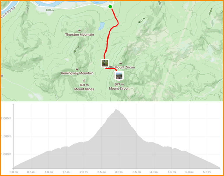
Tucked away in a part of Maine that most folks don’t get to too often, Mt. Zircon is another example of a moderately easy hike that pays dividends with an outstanding view. The 2.7 mile ascent, while quite steep toward the end, is an easy to follow ATV trail for the majority of the hike. At the top, you’ll be able to see some of Maine’s highest peaks in all directions. Saddleback, Tumbledown and Mt. Blue to the north. Old Speck and the Bald Pates to the west, Mt. Washington, the White Mountains and beyond!
Location
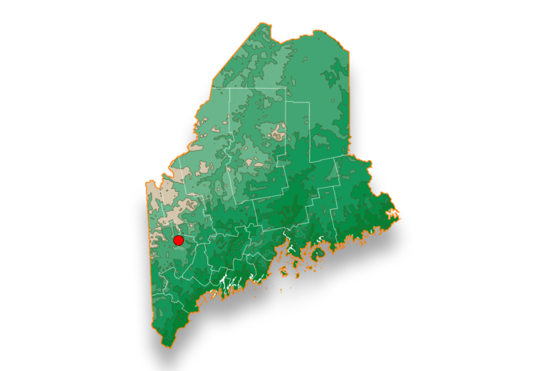
Access to Mt. Zircon is from 328 South Rumford Road in Rumford, ME. There is a sign for the trailhead. Several parking spots are available at the trailhead. Additional parking is available 100 yards east of the trailhead on South Rumford Road at the former site of the Rumford Water Co.
Pairs best with
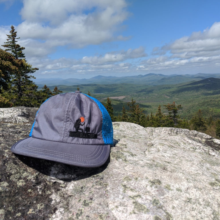
You’ll sweat, but not for too long on this particular hike. For that, we recommended replenishing those lost calories with Firestack. A Red IPA brewed with Galaxy and Mosaic Hops. You get a nice caramel malt backbone the supports dark fruits, red berries and pine. It definitely sets the vibe like no other. Bust open a bag of GORP, gnaw on a block of cheese. You earned this summit!

Hike Instructions
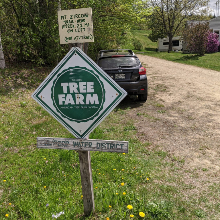
1) Drive to trailhead off of south Rumford Road.(Click link above for directions)
2) As you drive past the trailhead, you will see the trailhead sign (Photo 1). There are 2-3 tight spots right there off the road. If full, or you have a truck, there is additional parking about 100 yds south at a dirt turnoff.
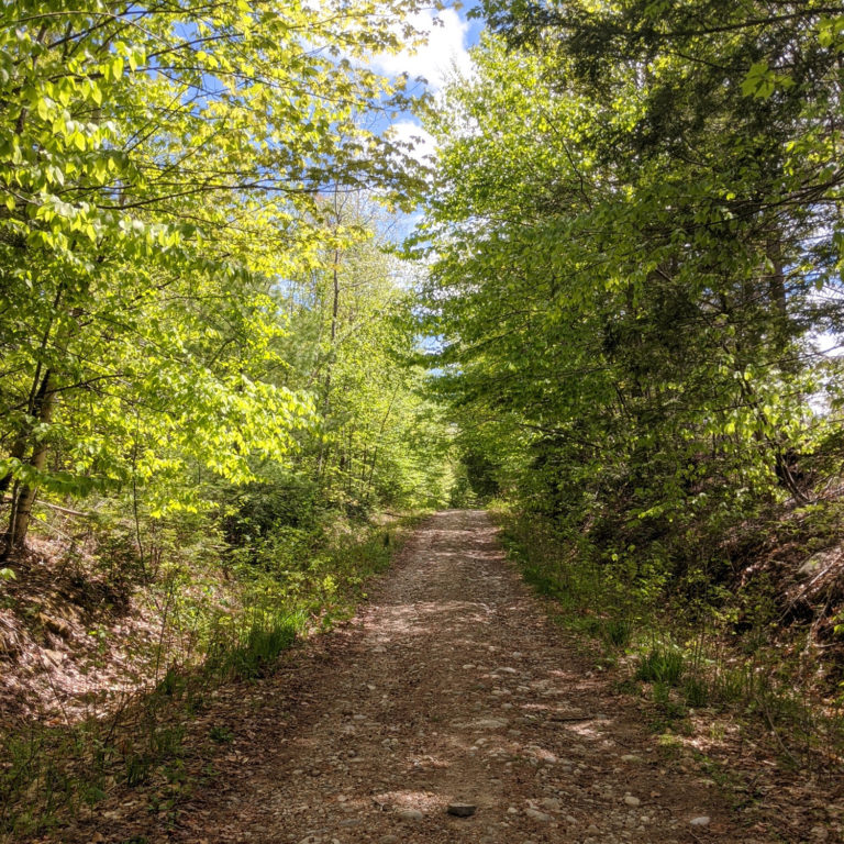
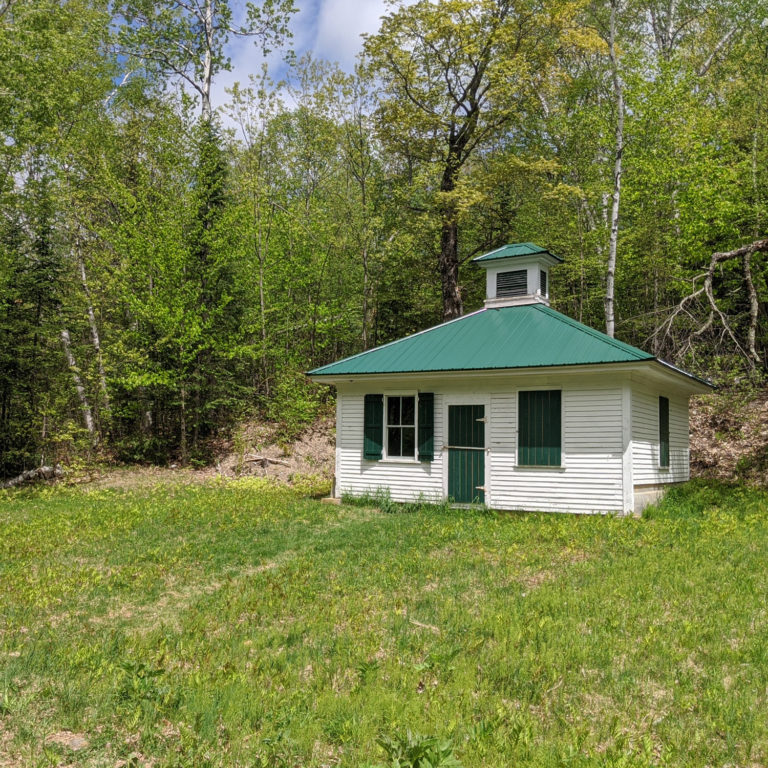
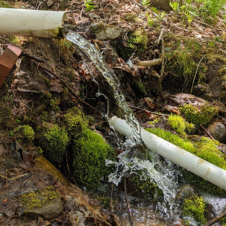
3) The Mt. Zircon trail begins at the gate and immediately sets out on a double track access road (Photo 2)that winds its ways up a hillside with a gradual and pleasant incline. The trail continues on with very few opportunities to get lost. At approx. 1.5 miles, you will come to perhaps the most interesting part of the hike, and it’s not a view. The Moon Tide spring house is all that remains of the once prosperous Zircon Spring Water Company (Photo 3). The spring, alleged to fluctuate with the cycle of the moon was lauded for its medicinal and healing. Its popularity surged throughout the region, at one point even supporting a hotel and resort. All the remains is the Spring House, and fortunately, access to the spring off the side of the trail (Photo 4). We would highly recommend filling up your water bottle at this point to enjoy some of the best water on Earth.
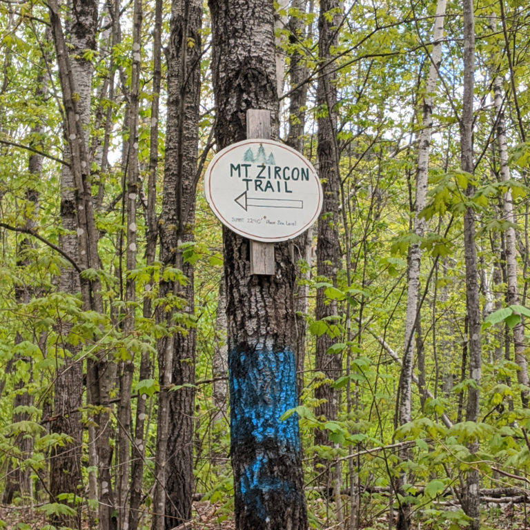
4) In a little bit over 1/2 mile from the spring, the Mt. Zircon trail takes a sharp left turn off of the access road. Beware of a difficult-to-see sign. If you miss this turn, you’ll be lost deep in Milton Township before you know it!(Photo 5).
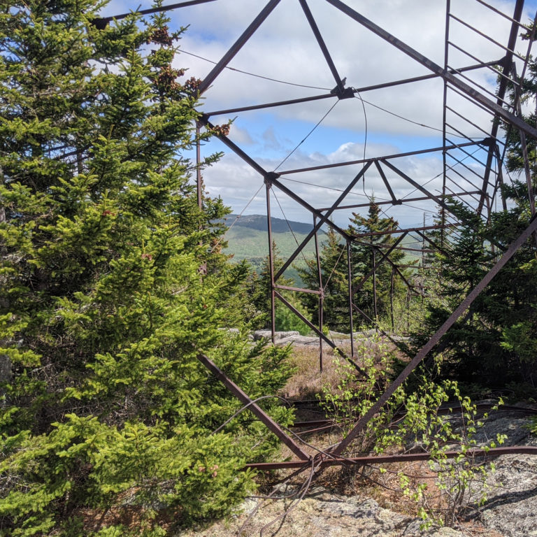
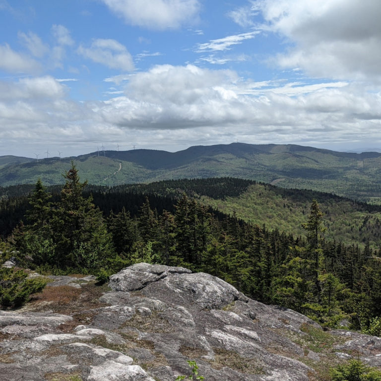
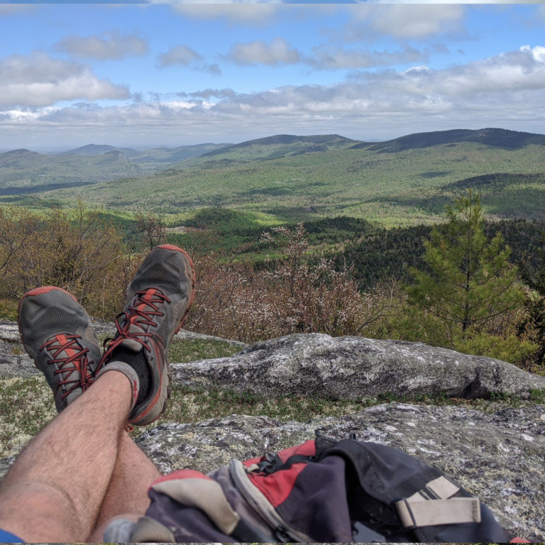
5)After the sharp left turn, the trail increases in steepness. In the final .5 miles, expect to gain about 1/2 of the elevation of this entire hike. But alas, you do it in the pursuit of a view and a fantastic one at that. As you ascend the final steep pitch, forest gives way to ledge as you find your self on a rocky summit with view in every direction (and a downed fire tower )(Photo 6). Do some exploring on the summit. You’ll find views in just about every direction. Grafton Notch, Sunday River, and the White Mountains to the west and south west. Tumbledown and Mt. Blue to the north(Photo 7). To the immediate south and southeast, you will have clear views of Bald and Speckled mountain (Photo 8). Take a seat, crack a beer, take a nap.
6) Once fully rested, turn around and descend the way you came, back down to vehicle
Hike Specs
Mt. Zircon is a true locals mtn. Check out the hike specs below
Hike Distance: 2.7 miles each way
Bottom Elevation: 632 ft
Top Elevation: 2240 ft
Grade: Gradual then steep
Difficulty: Moderate